With Major Revisions, the SPIRE Plan Becomes Our Region’s Surest Bet for Express Rail Service: A Mapped, Annotated Update.
22February 19, 2017 by seradt
UPDATED: These technical updates to the SPIRE plan were further revised in official ArcGIS plans linked here, superseding some components of the proposals detailed within this post. Please review the new plans to stay up-to-date with project developments.
—————>
For over a decade now, and principally advanced by the November 2016 election, the majority of voters within Sound Transit’s taxing district have committed themselves to the extension of the Link light rail line from Seattle to Tacoma Dome Station. The resurrection-in-spirit of the old interurban line of the Puget Sound Electric Railway, which dutifully linked the two cities between 1902 and 1928, manifested itself through a number of factors: the anguish over limited mobility options between the two cities; increasing congestion and delay; the failure to prioritize bus transit on existing roadways; environmental concerns, and; the pro-transit pull of our region’s growing urban cores. By 2030, a passenger-friendly rail system should again bridge that divide in a manner that no system has since the termination of interurban services nearly 89 years ago. Whatever one may feel regarding ST3, compliments to Sound Transit for this rather extraordinary achievement.
In a high-tech, fast paced region like the Puget Sound, however, the ±70 minute travel times between the two cities will eventually prove unsatisfactory; indeed, the primitive interurban had precisely 70 minute trip times scheduled, too, including padding, for their express services in 1922 (a separate, undated timecard details 65 to 75 minute express services). Damningly, this was achieved on a notably longer pioneer alignment that began on Occidental Avenue in Pioneer Square and ended not on Puyallup Avenue in Tacoma, but near old city hall in the crowded central business district. Though our ST3 rail investment will spur growth and positively affect the geography of the region, we are paying an enormous sum of money to establish transit services that are roughly comparable to those conceived in the late 19th century, constructed in the early 20th, and dismantled a few decades thereafter.
The SPIRE rail modernization plan was initially a 2015 reaction to the numerous technical criticisms of the Link extension toward Tacoma. It was a proposal that conveyed a potent message: despite the price and the press, Sound Transit’s multi-billion dollar rail plan was neither the visionary nor intelligent plan needed. Unfortunately, the SPIRE’s best mechanism for financing died with the passage of ST3, considering the core of its alignment rests entirely within the taxing district, and the existing services utilizing its right-of-way for their operations are already wildly popular. In the future, with rail service between Commencement and Elliott bays underway and Sound Transit largely working to pay down huge debts, it seems unlikely that a majority of voters would agree to a major upgrade of rail services on the heavy rail mainlines parallel to the Link corridor.
Consequently, the future genesis of the SPIRE plan will likely have to come in the shape of rail investments in the Cascades corridor to Portland, Oregon, representing a multi-state and/or federal effort to deliver quality express services to the region. Such an effort will be mandatory, in fact, should we ever insist on regional trains that travel at speeds swifter than 90mph (145kmh). That figure is the strict BNSF speed cap for passenger trains, with or without positive train control (PTC). Now, with the following improvements rendering the plan even more rational and executable, the Seattle-Tacoma-Olympia core of any higher speed rail project would almost certainly be the SPIRE line proposed here. Alternative alignments would cost billions more and require a dismaying planning process, the entirety of it vulnerable to collapse due to local politics and eminent domain battles.
SPIRE PLAN MODIFICATIONS
When originally proposed by this blog, the SPIRE plan was to feature routine operating speeds of 125mph (200kmh) on largely tangent track between Tacoma and Seattle, with antiquated curves widened to a minimum 6235ft (1900m) accordingly. However, multiple issues arose from this choice: grade crossings were required by law to be eliminated, raising costs dramatically; numerous homes, or even neighborhoods, were destroyed for some curve improvements; the speeds were unrealistically high for corridor commuter trains and had no real impact on lowering travel times, and; it failed to take advantage of higher equilibrium cants, in essence the sum of the tilt of the rails and the distance value of how fast a train can travel around curves before distress. The higher speed was a benefit to express travelers, though. Unfortunately, express trains were never meant to be the focus of the SPIRE plan.
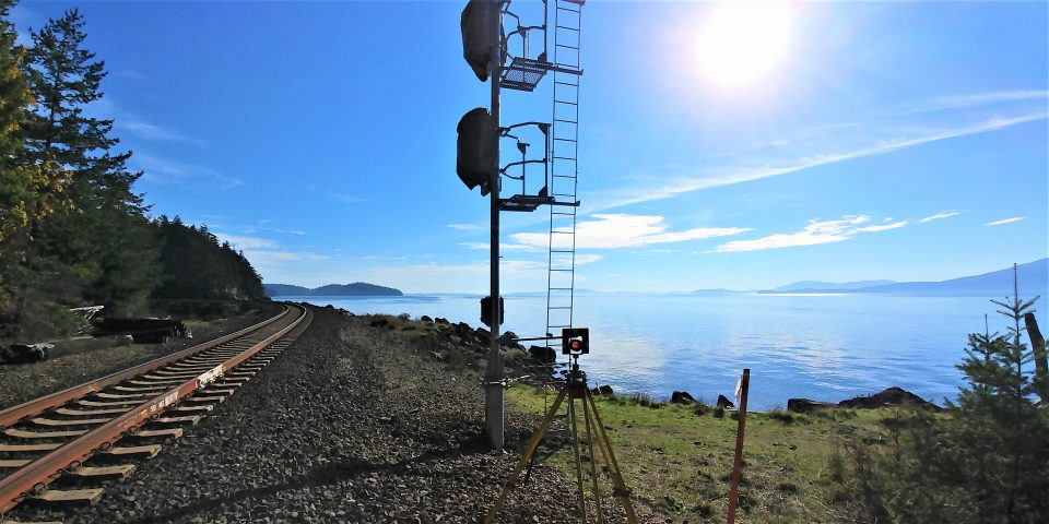
Modifications, which are presented below, lower the routine operating speeds to 100mph (160kmh) on track with 10in (254mm) of equilibrium cant, or 110mph (175kmh) on 12in (304.8mm). To accommodate these speeds, curves are widened to a far more sympathetic 3935ft (1200m), sparing numerous homes, businesses and streets from condemnation and destruction. On the express track from Auburn to Tukwila, over the new passenger-dedicated tracks from Tukwila to Georgetown, and from Lakewood to St. Clair, top speeds may remain at their original 125mph (200kmh) cap should investments be made to eliminate or avoid grade crossings on those stretches. As this blog has argued before, grade crossing elimination should be a safety priority for the region whether-or-not the SPIRE plan is realized, especially in the valley cities of Kent, Auburn, Sumner and Puyallup.
The speed update to the SPIRE plan allows for a piecemeal grade separation of the corridor—if at all—as the lower speeds no longer legally compel such a separation. While this does substantially lower the cost and complication of the project, it allows for the nuisance of approaching train horns to continue largely unabated.
This SPIRE update also includes a dramatically more precise measurement of rights-of-way based on technical standards from the California High Speed Rail Authority, BNSF, Deutsche Bahn, the Israeli Railways, LTD., amongst others. Elevation contours provided by the city of Seattle, and Pierce and King counties, also were useful in determining the location of critical civil works. This provides us further confidence in the strong technical feasibility of the SPIRE plan, for both the passenger and freight corridors. Roughly all prominent physical features along the railroad rights-of-way, with the exception of utilities, are now identified based on their likely impact.
Additional modifications concern new research and awareness into specific planning issues:
1) The Stampede Pass rail link to the freight corridor is now achieved via graded fill and bridges, rather than trenching. Geotechnical issues related to the water table precluded trenching, as did impacts to adjacent roadways and bridges (pg. 15).
2) A lengthy tunnel is no longer supported though Tacoma; instead, the current alignment is improved with widened curves, affecting some local streets. This avoids massive civil works under a busy urban zone, a project whose costs could haved swelled into the hundreds of millions of dollars (pg. 27).
3) Highway columns, especially on the new I-5 Puyallup River Bridge, were incorporated into the project and considered during the design. While some curves were altered to circumvent these columns, it is presumed on other, smaller bridges that steel would provide a means to relocate errant columns. On other bridges, still, a rebuild would likely be cogent due to end-of-life estimations (pg. 26).
4) A new alignment is proposed between Tacoma and Puyallup that roughly parallels the existing BNSF right-of-way. While the new alignment does include a modest tunnel, it avoids the evisceration of a neighborhood and spares numerous additional structures on tribal land. The alternative alignment remains in the SPIRE plan maps for consideration (pgs. 22, 25).
5) Near Olympia and Lacey, the Woodland Trail alignment was selected as the preferred option of accessing the center of Olympia, having proven incredibly amenable to express rail infrastructure using 1200m curves. It is now, by far, the best route to serve the people of the south Puget Sound (pgs. 37-41).
6) In Olympia, competitor siting options for the station were discarded for the location along Legion Way. It is far less disruptive than the alternatives, allows for UPRR to continue to access the Olympia port on their operational cargo line, and provides a fine location near both the city center and the capitol (pg. 47).
7) In the Nisqually Valley area, great pains were taken to avoid the destruction of hamlets and farms, all-the-while preserving 200kmh (125mph) speeds that support a high-speed link to Portland, Ore. The interchange from the SPIRE line to a central Washington high-speed line will probably be made in this rural area (pgs. 35-38).
8) Though the map represents a right-of-way capable of accommodating three tracks, the freight corridor is no longer presumed to be triple-track from the outset, but double. While the SPIRE plan will preserve enough space to allow for three mainline tracks on the entirety of the corridor, current daily freight train totals on the UPRR and BNSF do not warrant three active tracks. Only alongside the rail yards in Fife, Auburn and the Tukwila area can we presume that three main tracks will be useful at this time.
9) Now depicted on the maps are the recently constructed third main lines on the BNSF corridor between Auburn and Tukwila, with the intentional gap through Kent (the railroad has had difficulty acquiring property through the area, and it would further require destruction of Kent Station facilities to accommodate the third track). Should the Seattle to Portland passenger rail link be constructed, this section would need the third track to support express services. A third track would also be required south of Tacoma, though the location is undetermined and dependent on currently uncalculated timetable work. This work is underway and the maps will be updated accordingly.
10) A challenging stretch of right-of-way between Tukwila and SODO has been refined to avoid numerous structures, and now incorporates previously unaccounted-for civil works. Tweaks in the alignment have improved the line’s feasibility (pgs. 2-7).
11) Fort Lewis Station has since become Dupont / Fort Lewis Station, having been moved away from the Fort Lewis main gate and toward a more sensible location near Dupont and the fort’s Clark Road gate (pg. 34).
12) The north arrow is now facing up, mercifully.
These improvements, as well as the precision updates to track geometry, will allow us to better understand the impacts of the intelligent SPIRE proposal on our region. Furthermore, simple budgets and timetable string graphs are now able to be completed, providing us a much clearer picture of how transformational these rail services would be on our mobility and urban geography.
From here, I’ll let my plan speak for itself. I welcome scrutiny and constructive criticism.
——————–>
SPIRE Project Maps
- ArcGIS Interactive Map, detailing the whole of the SPIRE project on a viewer-friendly map.
- Before and After, a summary of key improvements in the core Seattle-Tacoma segment of the SPIRE plan.
SPIRE Mapbook Guide:
SPIRE Mapbook Pages:
- Seattle, King Street Station
- SODO
- Georgetown
- Boeing Field
- Duwamish
- Allentown
- Tukwila Station
- Orillia
- O’Brien
- North Kent
- Kent Station
- Thomas
- Emerald Downs
- Auburn Station
- South Auburn
- Pacific
- Dieringer
- North Sumner
- Sumner Station
- Puyallup Station
- Puyallup Valley West
- Clear Creek
- Hughes Siding
- Firwood
- Fife
- Tacoma, Freighthouse Square Station
- Nalley Valley
- The Mall
- South Tacoma Station
- Monta Vista
- Lakewood Station
- American Lake
- Fort Lewis Main Gate
- Dupont / Fort Lewis Station
- Atkins Hill
- Nisqually River
- McAllister Creek
- St. Clair
- Union Mill
- Lacey Central Station
- Eastside Olympia
- Long Lake
- Lacey Suburban Station
- Chambers Prairie
- Deschutes River
- Tumwater
- Olympia Central Station
——————–>
JUSTIFICATIONS
California High-Speed Rail Cross Sections
Track Geometry for High-Speed Railways
Railway Track Design Guidelines (≤250km/h)
BNSF Design Guidelines for Industrial Track
BNSF-UPRR Joint Guidelines for Grade Separations

[…] This post is copied in its entirety from an article I wrote, titled With Major Revisions, the SPIRE Plan Becomes Our Region’s Surest Best for Express Rail Service…. It is the latest entry of my blog, Transportation Matters, a Pacific Northwest-flavored blog that […]
LikeLike
[…] UPDATED: The February 20, 2017, technical updates to the SPIRE plan, linked here, supersede the proposals detailed within this post. Please review the new plans to stay up-to-date […]
LikeLike
[…] UPDATED: The February 19, 2017, technical updates to the SPIRE plan, linked here, supersede the proposals detailed within this post. Please review the new plans to stay up-to-date […]
LikeLike
[…] UPDATED: The February 19, 2017, technical updates to the SPIRE plan, linked here, supersede some aspects of the proposals detailed within this post. Please review the new plans to […]
LikeLike
Second comment: it’s worth designing the grade-separated connection to that small sorting yard serving industrial businesses south of Tukwila station. 😛
LikeLike
If such a connection near Orillia is necessary to build, and I make no assumptions about this either, it would be interesting and potentially complicating.
An interchange track could diamond across the SPIRE line here, or be elevated above it, connecting the sorting yard and the spur lines that feed into the warehouse district. Strict regulations would have to be imposed on operations here, too, for obvious reasons, but it is certainly technically feasible. We should thoroughly study the necessity of such connections, however, before we preserve freight businesses along the SPIRE line.
As you know, such connections imperil the use of advanced rail equipment and technologies that allow for successful, efficient passenger systems. A delicate balance is to be stricken here.
LikeLike
I should make it clear for the Mountain Division access that I’m thinking of something like the freight rail access onto the north end of the Newark City Subway, which is done with locked gates and total time separation. The Mountain Division has so little business that it can be satisfied by an occasional weekend midnight access to the line.
FRA regulations have been relaxing more and more about this sort of thing since the Newark City Subway arrangement was made and it might not even need to have that extreme a signalling system.
LikeLike
Wetlands! I hope you’ve checked wetlands regulations. I suspect that you want to completely avoid fill going over the Nisqually wetlands. Make it viaduct the whole way, see whether you have a smaller impact on the wetlands. I know it’s a long viaduct but the bridge decks can be mass produced, as was done with Link.
LikeLike
Excellent points!
All sensitive areas as defined by the State of Washington and the United States have been identified and avoided. The alignment near the Nisqually River is responsibly near the interstate transportation corridor, and can even be shifted closer if desirable.
The ratio between viaduct and fill is wholly hypothetical and subjective to change for precisely the reasons you suggested. I, too, think a long viaduct may work better in this location, but I chose to design it with fill quite like the adjacent interstate highway.
The long viaduct would also be useful for flooding, so great eye!
LikeLike
In the Nisqually area, viaducts & bridges also allow farmers to run their equipment underneath them.
—-
In regards to the Woodland Trail route (sigh) it’s going to be necessary to specify a new trail location.
The route restructuring ends up moving a number of roads to the north some to clear way for the railroad. I believe the correct thing to do in these cases is to locate the trail between the road and the railroad (obviously, with fencing between the trail and the railroad). It’ll serve as an enhanced sidewalk.
In places where there is not a road immediately north of the railroad, I suggest seeing whether a trail can be fit in to the north of the railroad (obviously, with fencing). I suspect that east of Central Lacey this will be straightforward. The old railroad ROW can actually be used in some of the places where the curves are being eased.
In central Lacey, the trail might actually be put *under* the railroad, replacing the usually-undesirable space under viaducts with something attractive and useful.
West of central Lacey, I think the trail should go to the south of the railroad, again using the old ROW where the curves are being eased. This should get you a trail as far as the existing Woodland Trail goes.
—-
Now this last proposal may be a bit of a stretch, but I bet it would get the trail supporters on board. The final high speed rail bridge approaching Olympia? Put a trail on it, along the south side of the bridge or underneath it. I don’t know if there’s enough height to put the trail underneath the railroad, or if it would be feasible to cantilever it off the side, but it would bring the Woodland Trail across the highways and into downtown Olympia.
I don’t know if you’ve noticed the vacant dead-straight space (former railroad ROW) in the middle of the “Capitol Crossing Apartments”, but if you don’t like using that space for the railroad line, the trail (on the south side of the bridge) could be dropped into it.
LikeLike
Nathanael, I think your ideas here are not only lovely, but very exciting.
I completely agree that an alternative trail alignment should be considered along the new rail line, exploiting the existing trail where curve corrections have moved the rails off of it.
The trail through central Lacey may be tricky, but I do think that the space exists, and clever street rearrangements could support the realignment of the trail.
Finally, in the spirit of the Walfridusbrug in Groningen, NL, or the Tilikum Crossing in Portland, the creation of a rail-trail bridge over the interstate and into central Olympia is absolutely brilliant and should be done. In fact, it will be included into the plan ASAP. Not only is the infrastructure critical for the SPIRE plan anyway, but it would become a key piece of the pedestrian and cycling network in the area. It would greatly assist with the reconnection of neighborhoods dissected by I-5.
It also wouldn’t really cost anything extra, relative to a larger project budget.
Great work.
LikeLike
Updated tonight! Pages 39-41 & 47.
I avoided the dead space between the apartment complex buildings as I am sure the residents would have a conniption at the prospect of losing their privacy to a public walk and cycle trail. Understandably so, too.
It is all tentative, however. Maybe they would love the direct inclusion into the regional network, who knows.
LikeLike
I think the most important part of the entire plan and the biggest difficulties are still from Black River Junction through to downtown. It is worth trying to figure out the costs of this segment, *and* the standalone benefits (if only this segment is done).
It seems like a bit of an indigestible hunk, in that I don’t see how to segment it into pieces with independent utility. South of there, almost all of the project can be broken into pieces of independent utiity, many as small as single curve easings.
Even the Woodland Trail route could be done from to St. Clair to Lacey while using the old junction, with no major bridges and would have independent utility; and could then be done from Lacey to Olympia with only one major bridge and independent utility.
But the section from Black River Junction north has a tunnel, a major cut, a cut-and-cover section to allow UP to go over, and a major viaduct, *plus* the reconstruction of the Spokane St. Viaduct, which is bound to be one of the most complicated bits.
And I don’t see a way in which anything less than the whole section would be useful. The whole section gets passenger and freight traffic out of the way of each other for the most congested section of the existing line, so that’s obviously useful; but anything less would remerge the passenger and freight traffic too early, creating the same old bottleneck.
Unless there’s something about the freight flows I don’t know. Would the viaduct separate passenger flows from slow-moving freight flows (due to lots of local yard action etc.) enough to be valuable by itself, without the rest of the passenger bypass route in this area? If it would, then it might be possible to get this done as the critical first step, and work south from there.
Even just the viaduct might be a bit indigestible. It’s worth figuring out what the smallest unit, working from the north, which shows significant and obvious benefit is.
LikeLike
Again, you are writing the truth.
This is a difficult section, yes, but these revisions reflect how an urban high-speed line can be snaked into Georgetown without too major of a disruption. It would not be that far removed from the levels of disruption that a new Link connection would create through the area.
The line needs study and detailed surveys. Furthermore, think of it as the “worst case scenario” where all other alternatives to incorporate the line fail.
Yes, the cut near I-5, which would straighten the hillside and then be reinforced with steel and/or concrete, is needed to squeeze in two extra tracks. This is doable, though.
The trench, however, may not be necessary, as the former Union Station passenger mains primarily only store local UPRR trains to Portland that could probably be assembled elsewhere south of UPRR’s Argo Yard.
The viaduct over the BNSF mains is an interesting piece of infrastructure, but save for some columns on the adjacent roadway, only disrupts a Costco parking lot.
The tunnel near Tukwila is a large civil work that I want to avoid. While it does usefully eliminate a long reverse curve, I will explore that area more to see if I can remove the tunnel and dart around the hill. That, however, may require taking a track or two from the nearby storage yard, which would require a study and BNSF/UPRR cooperation. So, the tunnel is fluid in the plan, too.
All in all, I would roughly budget these seven miles of greenfield alignment like I would any other urban rail project. There isn’t anything too scary about it, even though it is brand new railroad into Seattle’s heart. That will always be tough to accomplish, and I would argue this is as good as it gets for a brand new rail corridor.
Even at $75/mi, which I think is a very, very conservative estimate to cover a greenfield alignment along an existing railroad line that avoids buildings, it would cost a rather reasonable $500m. Compare the cost and benefits to ST3 over the same corridor, of which the public approved.
One thing to add: Spokane Street Viaduct should have no impacts to it. The SPIRE line will dodge its columns. Spokane Street, however, would either require grade separation or extensive protections, and those should be made now.
LikeLike
Oh: I found an industrial site on the branch east of Lacey (before it turns into the Woodland Trail). Have to check on that.
LikeLike
In addition to plotting a relocated Woodland Trail on your plans, it’s probably worth doing a more specific design of a Central Lacey station. In order to get Lacey buy-in for running the railroad this way… well, I think at an absolute minimum they’ll want their own station and they’ll want it to be nice. Probably in the block which currently houses Harbor Freight Tools, I’m thinking? There’s a lot of unimpressive non-historic structures and parking lots there (I’m guessing there used to be a freight rail yard).
LikeLike
Nathanael, your compliments here and on the STB are sincerely appreciated, and I agree that the revised plan is far stronger than previous iterations—dramatically so, in fact.
Your contributions to the SPIRE plan have been terrific.
I am all ears and eyes for your suggestions on station placement in Lacey. I want locals to be engaged, too. The current positioning is only for conceptual purposes and can be freely altered.
LikeLike
If such a connection is necessary to maintain, and I make no assumptions about it either way, the area around Freighthouse Square Station would be the best place to do it. I would be curious over how much superelevation of the rails a typical Tacoma Rail freight can tolerate, as the existing curves are designed at 6″; otherwise, a third track siding can be built north of the passenger right-of-way to avoid the need of any curve modifications. Also possible is a reduction of the superelevation of the north curve (1110m), which would affect speed limits, but the universal Tacoma stop would mitigate any time penalty that would cause, if any.
LikeLike
(Looks like my original Mountain Division comment which you were replying to got lost.)
Here’s the thing: Mountain Division has *active customers* and they’re served from the Tacoma yards. There’s really no way to avoid maintaining that connection; serving them from Chehalis doesn’t work.
https://www.mytpu.org/tacomarail/service-area/mountain-division.htm
https://www.mytpu.org/tacomarail/general-information/tacoma-rail-system.htm
Customer list:
https://www.mytpu.org/file_viewer.aspx?id=57685
Pay particular attention to the customers located in Roy and Tenino. I don’t expect these two generate much traffic, but you’d face (federal!) complaints if they got cut off, and it’s City policy to promote traffic on the Mountain Division — so you kind of have to assume that you’ll support them.
So this was my first plan to make the connections:
(a) Mountain Division to Freighthouse Square in pretty nearly the same place the connection is in now (you can see it under the Interstate just west of East C Street). This should be no problem.
(b) Freighthouse Square to the Port of Tacoma:
I think the best thing is to have a branch come out on the south side of the new freight mainline heading east looping tigthly through the woods and the industrial property parking lot (remember these trains already go super super slow), and then rising as a northern siding until after crossing Portland Avenue. With the junction west of Portland Avenue it can be on tangent track and not mess up the superelevation.
I did however think of another, better, but more expensive plan, and it has potential wetlands problems:
Run the Mountain Division into a trench in the eastern Gulch, *under* the line from Tacoma to Lakewood. Run it under E. 25th St. Run it under Puyallup Avenue. Run it up and into a wye with the freight mainline. The properties in the area are exceptionally low-value. I’m not sure if the vertical clearances work, but 1000 feet of trenching could get the Mountain Dvision freight completely out of the way of passenger traffic. Both the Tacoma-Lakewood line and Puyallup Ave are already partly elevated (though it looks like 25th St. isn’t) so the trench wouldn’t need to be an entire train deep.
I’d maintain the current connection from the Mountain Division to Tacoma Dome station but only for potential/occasional tourist train service, which would remove most of the conflicts inherent in freight use.
Probably worth diagramming both plans.
LikeLike
[…] Some rail enthusiasts maintain that light rail could reach Olympia much sooner, or have developed their own visionary proposals for high-speed rail along the corridor. […]
LikeLike
[…] and, critically, the implementation of SPIRE, which was created by this blog in 2015 and researched and promoted by it ever since. Separated trackage allows for more sophisticated passenger equipment (the […]
LikeLike
[…] transit improvements here, and it delivers an equivalent or superior product. Rail systems are aggressively supported by this blog where appropriate, but not when they are 7.5-times the cost of an equally beneficial bus line. Such […]
LikeLike